|
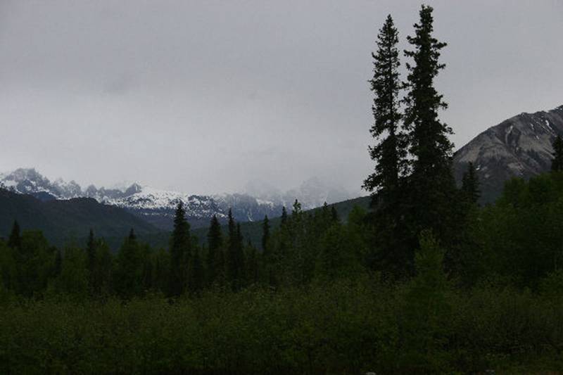
A few weeks ago we drove down the Parks Highway to Anchorage. On the way we stopped a bit south of Denali National Park at Mile 147 where there is the Alaska Veterans Memorial along with a rest area. This spot is a good place to view Denali, aka Mt McKinley. As you may know, 80% of the time “The Mountain,” as it is called in Alaska, is not visible because of cloud cover. In spite of that, we stopped and took this photo.
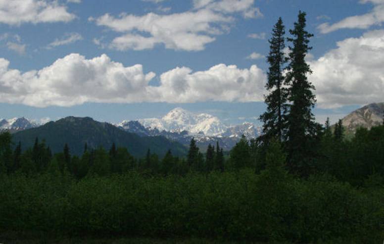
You probably don’t see The Mountain…neither did we. But on the way back up the road, a few days later, we took the following shot.
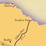
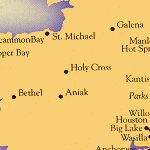
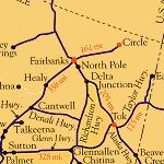
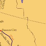
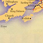
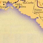
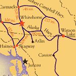
Quite a different view, isn’t it. Of course the photo doesn’t do justice to the magnificence of The Mountain! I mentioned last week that I would say more about the highways in Alaska. While all of the major highways have route numbers, within Alaska roads are almost invariably referred to by name, and not by number(s). Most Alaska residents are unfamiliar with official highway numbers even for those highways that they use frequently. For instance, the road from Fairbanks to Anchorage is officially Alaska Route 3, but everybody calls it the Parks Highway. Dalton Highway - This 415 mile long gravel surfaced “highway” begins at mile 73 of the Elliott Highway, north of Fairbanks, and ends at Dead Horse a few miles from Prudhoe Bay. It is also known as the Haul Road and was built during construction of the Alaska Pipeline. Steese Highway - The Steese Highway extends 162 miles from Fairbanks to Circle, a community on the Yukon River just 50 miles below the Arctic Circle. (Circle was named by miners in the late 1800s who believed that the town was on the Arctic Circle.) The first 44 miles of the route are paved and the remainder is, as they say in Alaska, “a good gravel road.” I guess that depends on your interpretation of “good.” Parks Highway – Extending 358 paved miles from Fairbanks to Anchorage, it is the state's widest and best year-round road. Access to Denali National Park is along this route, 120 miles south of Fairbanks. Denali Highway - This scenic, 133 mile long gravel surfaced route connects Cantwell Junction (mile 210 on the Parks Highway) with Paxson Junction (mile 177 on the Richardson Highway). Seward Highway - This 127 mile National Forest Scenic Byway connects the cities of Anchorage and Seward. The first 50 miles of the highway twists and turns along the base of the Chugach Mountains, and the shore of Turnagain Arm. The 37-foot tides here are exceeded only by those in Nova Scotia's Bay of Fundy. The waters racing out of the inlet expose miles of mud flats and when they return frequently create 6-foot bore tides. History/Geography Lesson: Turnagain Arm was named by William Bligh of HMS Bounty fame. Bligh served as Captain James Cook's Sailing Master on his 3rd and final voyage, with the aim to discover the Northwest Passage. Upon reaching the head of Cook Inlet, Bligh was of the opinion that both arms up the bay were the mouths of rivers and not the opening to the Northwest Passage. Under Cook's orders Bligh organized a party to travel up the first arm, which quickly returned to report that it indeed lead only to a river. Afterwards a second party was dispatched up the second arm and it too returned to report only a river lay ahead. As a result of this frustration the second body of water was given the disingenuous name "Turn Again". Sterling Highway - This route runs 135 paved miles along the western edge of the Kenai Peninsula and features extraordinary mountain scenery, sparkling lakes, glacier-fed streams, and beautiful coastal inlets. Beginning at Sterling Junction on the Seward Highway, this route extends to the “end of the road” at Homer. Richardson Highway - The 364 miles of this paved highway, from Fairbanks to Valdez, constitute one of the state's most scenic routes. Delta Junction, about 100 miles east of Fairbanks, is the beginning/end of the Alaska Highway, and the point where the Richardson turns south toward Valdez. Access to Wangell-St Elias National Park is along this route. Glenn Highway - This paved highway runs 328 miles from Anchorage to its intersection with the Alaska Highway at Tok. This route joins the Richardson for about 13 miles between Glennallen and Gakona Junction. Alaska Highway – This two-lane, paved 201 mile road extends from the Canada – US border crossing to Delta Junction, the official end of the 1422 mile long Alaska Highway. Taylor Highway - Extends 160 miles from Tetlin Junction (mile 1302 on the Alaska Highway) through Chicken, to Eagle. Only 60 miles of the highway are paved. Alaska Joke: Why did they name the town Chicken? They couldn’t spell Ptarmigan! Edgerton Highway - A minor paved highway that extends 33 miles from the Richardson Highway near Copper Center to the town of Chitina. The McCarthy Road is a 58-mile gravel extension from Chitina to McCarthy. Elliott Highway - All but the first 28 miles of this highway is a two-lane gravel road which extends 152 miles from Fox, about 10 miles north of Fairbanks, to Manley Hot Springs.
More than you ever wanted to know about the highways in Alaska. Well, I hope it wasn’t too boring.
By far the most exciting thing that happened last week was my quick trip to Denver to see Coralyn…Lisa and Marc were there too. I flew down on Wednesday night, arrived Thursday morning and spent 4 days enjoying Coralyn. On Saturday, Marc and I helped Coralyn take her first real bath in the kitchen sink. Here’s a photo of her drying off…think she’s happy???
Did you want to see more photos??? I’ve got a couple more around here somewhere…
P&P |


| <--Previous | Back to Index | Next--> |