|
This past week we were fortunate enough to take a drive/fly trip about 400 miles north of Fairbanks to a Nunamiut Eskimo town called Anaktuvuk Pass.
We left Fairbanks at 5:00 AM one morning along with 5 other travelers and a guide/driver. The driver was a woman about 55 years old who is also a Geography Professor at the University of Alaska, Fairbanks. She had lots of great information about the history and culture of Alaska and the Native Peoples who historically lived in the area.
The first part of our drive took us up the Elliott Highway from Fairbanks through the little town of Fox where there were several gold mines. A few miles beyond Fox, we passed the Hilltop Truckstop, famous for their home made pies. Our first stop was in the rural community of Joy, Alaska, where the Arctic Circle Trading Post provided Men’s and Women’s out houses…Classic, wooden, hole-in-the-wood, out houses. Many of the folks in the van felt like they knew why the place was called “Joy!” I think I heard several of them saying, “Joy” as they trotted off toward the out houses. Unfortunately the Trading Post was not yet open for the season.
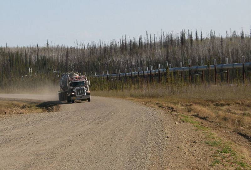
A few miles further on, the paved Elliott Highway turned off toward Manley Hot Springs and the unpaved Dalton Highway headed toward the Arctic Ocean. The Dalton, sometimes called the Haul Road, was built to aid the construction of the Trans Alaska Pipeline between 1975 and 1977. The road is still the only land link to the vast area of Alaska north of Fairbanks. Our van turned up the Dalton Highway toward the Arctic Circle.
Trucking on the Dalton Highway along with the Trans Alaska Pipeline
The Pipeline runs pretty much parallel to the Dalton Highway all the way up to Prudhoe Bay, well beyond our destination. Much of the Pipeline is buried except where it crosses permafrost. While the surface shown in the photo is not frozen, our guide drove a piece of rebar into the ground with a hammer. It went down about 3 inches and stopped. Additional hammer blows did not drive the rod any further. You could stick your finger in the hole and feel the cold from the permafrost.
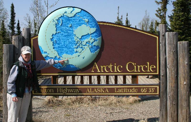
We crossed the Yukon River and stopped for a picnic lunch at a nice roadside “park” near Finger Mountain. While there were no picnic tables, there were pit toilets (More Joy!), and a nice rocky hillock where we all sat in the sun and ate our lunches. After lunch we headed for the Arctic Circle.
After the brief ceremony at the Circle, we headed up the road to the settlement of Coldfoot, where the drive portion of our journey ended. We all boarded a nine passenger prop plane for the half hour flight through the Brooks Range to the small settlement of Anaktuvuk Pass, a Nunamiut Eskimo community dependent upon subsistence activities. The current population of the 4.8 square mile settlement is 302 persons. There are no roads through the Brooks Range leading to Anaktuvuk Pass. The only way in or out is by air.
We spent about an hour walking around the settlement with a local guide who talked about life in this remote area. There is a cultural museum in the village, but it was closed the day we were there.
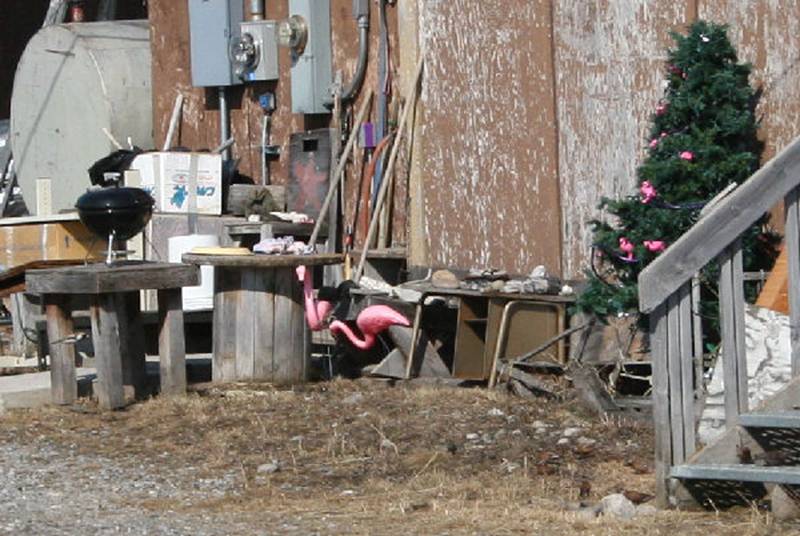
Familiar wild life seen in an Anaktuvuk yard…
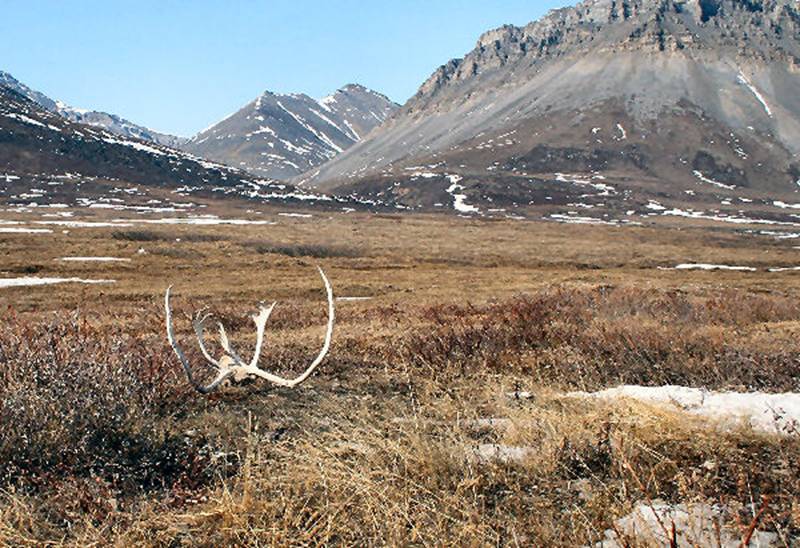
View from the edge of Anaktuvuk toward the mountains…
The flight back to Fairbanks was uneventful. We had several great views of the Brooks Range, the Gates of the Arctic National Park and the Trans Alaska Pipeline. We landed at the Fairbanks airport at 6:30 PM after a 13 and a half hour adventure.
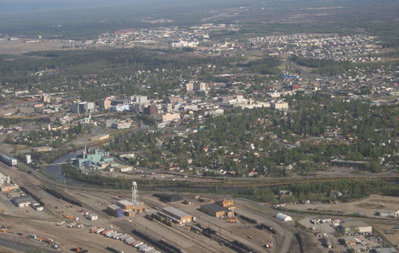
View of Fairbanks, second largest city in Alaska, population 32,000 (Area population 85,000)
If any of you have trouble viewing the photos, drop me a note and I will send them to you as attachments. I’d attach them here, but I don’t want this message to take up that much space in your mailbox!
P&P
|
| <--Previous | Back to Index | Next--> |